ZondGM3D - 三维地球物理数据处理和模拟软件
ZondGM3d 程序旨在通过(陆地和航空变体)对重力和磁数据进行三维解释。在重力测量中研究了不同密集异质性引起的重力异常。通过减去正常场和减少量,排除了主岩和周围地形的影响。磁测量是研究由含有铁磁矿物的岩石产生的磁场。将表面场测量与岩石的磁性联系起来,可以得出磁性物体存在的结论。
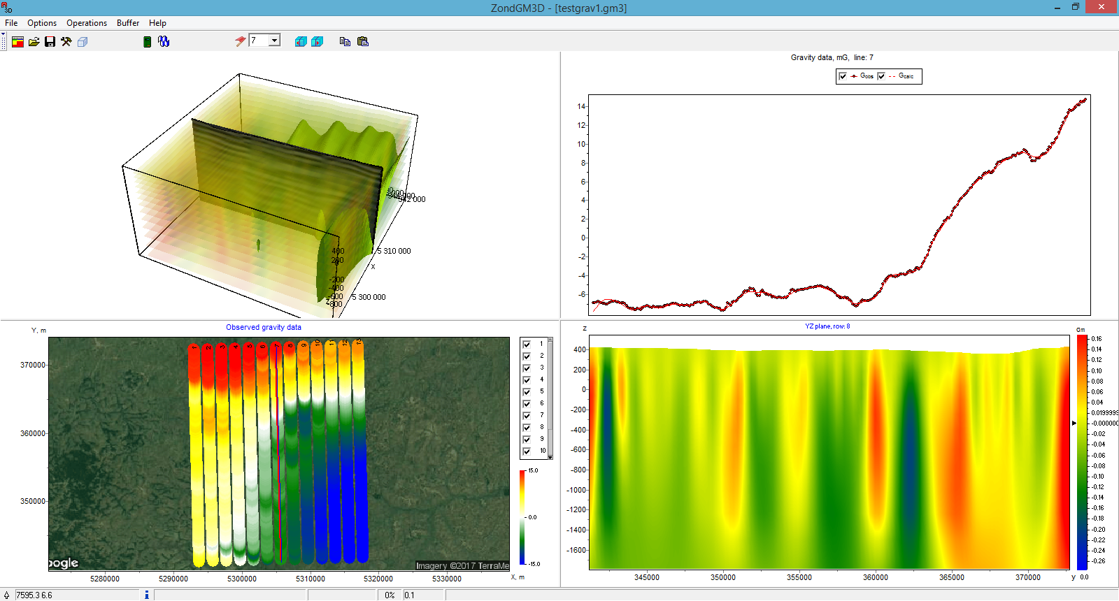
ZondGM3d 代表了重力和磁学方法的现成解决方案,并解决了从数学建模到现场数据处理和解释的广泛问题。方便的界面和多种数据可视化功能可以很大程度地解决各种地质问题。
ZondGM3d 使用简单明了的数据格式,可以轻松组合各种观测系统,包括地形设置的不同变体和其他附加信息。
提供了允许以自由形式可视化数据的特殊图形模式。
在程序中实现了以各种截面和等值面形式显示的三维模型的一些变体。
阻止现场测量的阶段是对工作现场的岩石物理结构进行数学建模。建模提供了一个机会,可以选择观测系统的参数,以决定制定地质问题。

由于程序的一般任务是密度和磁化率的反演,所以在 ZondGM3d中实现了一些反问题决策的变体,它们的基本是:平滑反演——得到光滑模型和聚焦——得到岩石物理参数的分段光滑模型有深度。
虽然程序的设计特别考虑了先验数据会计。由于逆地球物理问题的等价性,所获得结果的质量很大程度上取决于使用的先验数据量。在 ZondGM3d 中,可以使用先验模型作为反演中的参考,为测量、固定和限制不同单元的变化特征设置权重。还可以导入和显示其他方法的测量结果和提高结果质量的钻孔数据。
【英文介绍】
ZondGM3d program is designed for three-dimensional interpretation of gravity and magnetic data by (land and aero variants). Anomalies of gravity caused of different dense heterogeneity are investigated in gravity survey. Influence of host rocks and surrounding topography is excluded by subtraction of the normal field and reductions. Magnetic survey is studied field generated by rocks that contain ferromagnetic minerals. Connection of measured on the surface field with magnetic properties of rocks allows to conclude about existence of magnetic objects.
ZondGM3d represents ready solution for gravity and magnetic methods, and solves wide range of problems from mathematical modeling to field data processing and interpretation. Convenient interface and variety of data visualization features allow to solve wide range of geological problems with maximum effectiveness.
ZondGM3d uses simple and clear data format which allows easily combining various systems of observation, including different variants of the topography setting up and other additional information.
Special graphics mode that allows to visualize data in the freandly form is presented.
Some variants of three-dimensional model display in the form of various sections and isosurfaces are realized in the program.
Important stage which prevents field measurement is mathematical modeling of petrophysical structure of work site. Modeling gives a chance to make a choice of optimum parameters of the observation system for decision of formulated geological problem.
As the general task of the program is inversion of density and magnetic susceptibility, some variants of inverse problem decision are realized in ZondGM3d, basic of them are: smoothing inversion – to get smooth model and focusing — to get piece-smoothed model of petrophysical parameters with depth.
While program was designed special consideration given to a priori data accounting. Because of equivalence of inverse geophysical problems, quality of the obtained results strongly depends on the amount of a priori data used. In ZondGM3d there is possibility of weights setting for measurements, fixing and limits making of changing features of different cells, using of a priori model as reference in inversion. There is also possibility to import and display results of measurements by other methods and cross-boreholes data that improved quality of results.
- 2026-02-09
- 2026-01-20
- 2026-01-16
- 2026-01-12
- 2026-01-12
- 2026-01-09
- 2026-02-05
- 2026-02-05
- 2026-01-28
- 2026-01-26
- 2026-01-26
- 2026-01-16


