Visual HELP - 填土设计软件
Visual HELP是美国环保局HELP模型的基础上,为填埋场的设计、预测淋滤液堆积和评估淋滤液向地下水的渗漏而开发的。可用于垃圾填埋场设计、渗滤液运移聚集趋势预测、渗滤液向地下水中运移的可能性评估等。作为一款基于Windows的软件,Visual HELP可用于设计模型并评价模拟结果。
基于HELP的垃圾填埋场水文设计软件
Visual HELP将新版本的HELP模型与操作简便的界面和的绘图功能结合起来,用于构建地下水模型并评价模拟结果。
Visual HELP采用软件工程领域前沿的技术,并引入了新方法,用于:
-
项目可视化与管理
-
生成输入数据,展示模拟结果
-
实现模型间的数据共享
借助Visual HELP,用户可以进行以下操作:
-
以图表形式创建填埋场不同区域的多个剖面图
-
可自动生成各地可靠的气象数据(或创建所在区域的数据)
-
运行复杂模型模拟,以估计在可变天气条件下通过填埋层的体积和流量
-
使用模拟数据的日、月和年图表解释和分析模型结果
-
使用内置报表生成器自动生成模型结果的报表
产品概况
主要功能:
-
易于使用—界面的熟悉设计和功能使其易于学习,并且可以使用可用模型进行模型开发
-
新建项目向导—通过逐步向导来指导您完成整个过程,创建模型(提供了模型模板以帮助您开始做项目)
-
项目管理—基于项目的数据管理系统使用户从处理单独项目的大量文件中解放出来
-
可定制的单位—从预定义的单位模板中选择或为模型参数创建自己的单位模板
-
输入数据—项目树可让您查看和修改模型轮廓的结构上的轮廓,或复制模型数据文件以执行多个模板以进行灵敏度分析
-
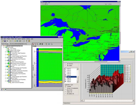
模型纵断面图—纵断面图以图形方式显示模型纵断面的几何形状,尺寸,层结构和地层
-
数据库链接—可定义的土壤参数数据库链接到输入形式,以自动输入所选值
-
WHI Weather Generator—内置的WHI Weather Generator生成长达100年的统计可靠天气数据,用作输入
-
—在同一图形建模环境中创建模型概要文件,运行模拟,可视化结果并创建报告文档
-
结果表示—Visual HELP带有功能的图形组件,用于以图形或表格形式可视化模拟结果
-
自动报告生成器—单击按钮,即可创建带有列表化的输入数据,配置文件图形和结果显示的富文本文档
-
团队合作—Visual HELP团队合作环境,以便可以在网络系统上运行项目文件
-
数据共享—从Visual HELP导出补给数据(入渗率),以用作Visual MODFLOW等饱和地区地下水模型中的补给边界条件数据
主要
-
Visual HELP地下水软件包拥有大量模拟工具和设计组件,帮助您实现可视化
-
Visual Help界面
利用Visual HELP直观的界面结构和绘图工具,您可以地选用HELP模型的基本功能和高等功能。
-
项目创建
Visual HELP界面的逻辑结构帮助您迅速获得经验曲线,从而可在几分钟内生成并修改典型剖面图。
-
SWS气象生成器
作为内置组件,SWS气象生成器可为您提供各地100年来的可靠气象统计数据。这一的工具采用的数据库涉及3000多家国际气象站,并各个地区的历史气象数据。
-
显示并证明模拟结果
Visual HELP为您提供绘图工具,可帮助您正确分析和解释模拟结果,并获得质量报告图表和数据总结。
Visual HELP模型结果
使用这个的图形工具可对每日、每月和每年的流量和体积进行报告。
模型结果时间序列数据并用于:
-
地表数据:地表存储、融雪、径流、入渗、蒸发、植被生长和土壤水分储存
-
地表下的数据:横向层排水、通过层渗流、通过土工膜内衬渗透物和在层的平均落差
模型设计
Visual HELP是用的图形用户界面设计的,用户友好的图形工具和的数据处理过程使您能够方便的访问帮助模型的基本和高等功能,:
-
用于查看和修改图层和几何图形的模型纵断面和交互式显示
-
基于gis的交互式天气发生器开发帮助模型输入
-
42种填埋材料的内置数据库
地下水建模
Visual HELP能够预测季节性对地下水补给率的影响,使它成为地下水流模型软件的拍档产品,如Visual MODFLOW Premium。
输出流量数据(每日、每月或者年的格式)到Visual MODFLOW Premium中,说明场地变化的地下水补给率。现在,地下水可以用它来提高地下水流量模型的可靠性和质量了。
应用范围
-
卫生填埋场的水文设计
-
评估填埋场内渗漏液的渗入率和入渗体积
-
评价填埋场防渗膜/防渗粘土的性
-
确定性的垃圾填埋场的上限,考虑边坡、植被和气候条件
-
预测用于Visual MDOFLOW的地下水补给率
-
产生统计学上可靠的气象数据
系统要求
-
PC Pentium
-
32MB内存
-
25MB可用磁盘空间
-
VGA显卡和鼠标
-
Windows 2000/XP
注意: Windows XP 32位以上的操作系统不正式Visual HELP软件。
【英文介绍】
Visual HELP is the most advanced hydrological modeling environment available for designing landfills, predicting leachate mounding and evaluating potential leachate seepage to the groundwater table. Visual HELP combines the latest version of the HELP model (v.3.07) with an easy-to use interface and powerful graphical features for designing the model and evaluating the modeling results. This latest version of the HELP model addresses many of the limitations and bugs from earlier versions, and also includes several new analysis features.
Visual HELP uses the latest technologies in software engineering to introduce many new methods for visualizing and managing your projects, generating input data, presenting modeling results, and sharing data between models.?The result is a powerful and easy-to-use modeling tool that makes hydrologic landfill modeling more practical and accessible than ever before!
This completely-integrated modeling environment allows the user to:
Graphically create several profiles representing different parts of a landfill
Automatically generate statistically reliable weather data for virtually any location in the world (or create your own)
Run complex model simulations
Visualize full-color, high-resolution results
Prepare a summary document (tables and graphs) for your report
For professional applications in landfill design, Visual HELP is the only software package you will ever need!
Visual HELP applications
Landfill design and optimization:
Simulate multiple landfill profiles to find the most suitable design
Evaluate leachate mounding or leakage problems with current landfills
Determine the effectiveness of landfill caps for reducing leachate mounding
Design and optimize leachate collection systems
Groundwater recharge estimation:
Visual HELP has also proven to be an extremely valuable tool for accurately predicting seasonal groundwater recharge for periods of up to 100 years for use in MODFLOW models.? This seasonal recharge data has proven to significantly influence the vertical migration of contaminants through the unsaturated zone.
About the HELP model
The HELP model is a quasi-two-dimensional, deterministic, water-routing model for determining water balances.?The following is a description of the HELP model as derived from the HELP program reference manual:
The HELP program was developed by the U.S. Army Engineer Waterways Experiment Station (WES), Vicksburg, MS for the U.S. Environmental Protection Agency (EPA), Risk Reduction Engineering Laboratory, Cincinnati, OH, in response to needs in the Resource Conservation and Recovery Act (RCRA) and the Comprehensive Environmental Response, Compensation and Liability Act (CERCLA, better known as Superfund) as identified by the EPA Office of Solid Waste, Washington, D.C.?The primary purpose of the model is to assist in the comparison of landfill design alternatives as judged by their water balances.
The Hydrologic Evaluation of Landfill Performance (HELP) model was developed to help hazardous waste landfill designers and regulators evaluate the hydrologic performance of proposed landfill designs.? The model accepts weather, soil and design data and uses solution techniques that account for the effects of surface storage, snowmelt, runoff, infiltration, evapotranspiration, vegetative growth, soil moisture storage, lateral subsurface drainage, leachate recirculation, unsaturated vertical drainage, and leakage through soil, geomembrane or composite liners.?Landfill system including various combinations of vegetation, cover soils, waste cells, lateral drain layers, low permeability barrier soils, and synthetic geomembrane liners may be modelled.? Results are expressed as daily, monthly, annual and long-term average water budgets.
The original version of the HELP model was first developed at WES in 1984 (Schroeder et al., 1984a and 1984b).?Since then there have been many advances in the technology and scope of the model and many of the defects in the code have been corrected.?The latest version of the HELP model is version 3.07 which contains many significant improvements and enhancements over the previous versions.?The following is a brief outline of the enhancements that have been made since Version 2 of the HELP model (Schroeder et al., 1988a and 1988b).
The number of layers that can be modeled has been increased
The default soil material texture list has been expanded to contain additional waste materials, geomembranes, geosynthetic drainage nets and compacted soils
The model now permits the use of customized soil textures
Computations of leachate recirculation and groundwater drainage into the landfill have been added
Leakage through the geomembranes due to manufacturing defects (pinholes) and installation mishaps (tears and punctures) is accounted for.
Estimation of surface runoff has been improved to account for large landfill surface slopes and slope lengths
The snow-melt model has been replaced with an energy-based model
The Priestly-Taylor potential evapotranspiration model has been replaced with a Penman method that incorporates wind and humidity effects as well as long-wave radiation heat losses
A frozen soil model has been added to improve infiltration and evapotranspiration predictions in cold regions
The unsaturated vertical drainage model has also been improved to aid in storage computations
- 2026-01-20
- 2026-01-16
- 2026-01-12
- 2026-01-12
- 2026-01-09
- 2026-01-05
- 2026-02-05
- 2026-02-05
- 2026-01-28
- 2026-01-26
- 2026-01-26
- 2026-01-16


